A Boston Public Library Exhibition Showcases The Unsung Role of Women in Cartography

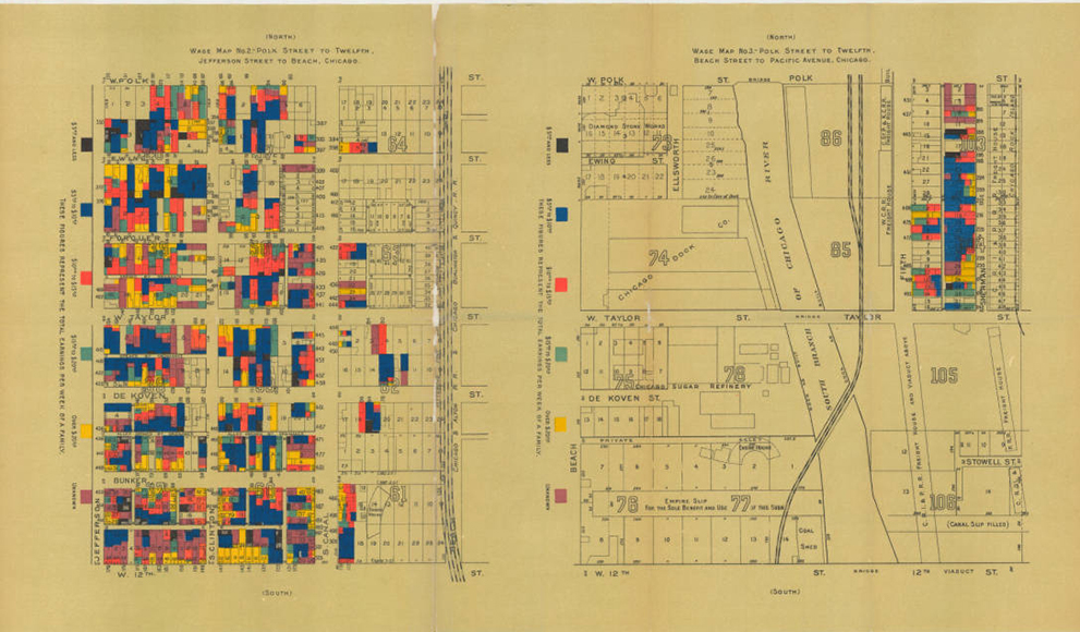
Included among the 40 maps, globes, and atlases on display (all made by women from the 17th through the 21st century) in a new exhibition at the Boston Public Library is a late 19th-century map of immigrant settlements in Chicago compiled by Agnes Holbrook, Class of 1892.
Holbrook was a resident of The Jane Addams Hull House. Founded in 1889 as a social settlement, Hull House was a community of women that provided social and educational opportunities for working class people in the surrounding neighborhood. The residents also advocated for legislative reforms addressing issues such as child labor, women's suffrage, healthcare reform and immigration policy. In 1895, they published the Hull House Maps and Papers, a series of essays and statistical information modeled on similar research on poverty and living conditions in London.
Holbrook’s map is one of the first to show immigration patterns in an American city. According to a BPL press release, her map "also foreshadows modern GIS mapping, using color and statistics to present social data." Holbrook’s education at Wellesley included coursework in statistics and art, both of which, according to a publication by the International Geographical Union, "prepared her well for translating geographical data."
Histories of map-making, according to a Boston Globe article on the BPL exhibit, generally neglect the important role women have played in the process for the last 500 years. Today, women are active in all aspects of cartography and are leaders in the world of Geographic Information Systems (GIS) and digital mapping.
GIS is used in numerous courses and research projects at Wellesley. The Wellesley community recently came together for the College's fifth annual GIS Day. Hosted by the Quantitative Reasoning Program and Library and Technology Services, the day brings faculty and students together to discuss mapping and spatial analysis used in classes and research on campus.
"One of the best things about GIS Day is that it brings together people from very different disciplines that [might not] otherwise share tools or ideas," said Carolin Ferwerda, Instructional Technologist for GIS & Statistics. Visit the GIS Day website for a full list of speakers and topics from this year and past years.
The campus geared up for GIS Day by celebrating Wellesley's map collection. Maps from the collection, which date from the 1890s through the 1990s, hung in the Margaret Clapp Library. There was also an exhibit of maps from Special Collections and Archives in the Clapp Reference Room that included "everything from beautiful 16th century woodcut maps to adorable pocket-sized maps of campus from the early 1900s," according to Ferwerda.
The Boston Public Library exhibit, Women in Cartography: Five Centuries of Accomplishments, opened Saturday, October 31, and is on display at The Norman B. Leventhal Map Center at the Central Library in Copley Square through March 27.
